Travel Notes / 2026 ・ No.05
Okutama in a Day
At Tokyo’s far western edge: from Lake Okutama down the Tama River, by gorges, suspension bridges and a sake brewery
Published
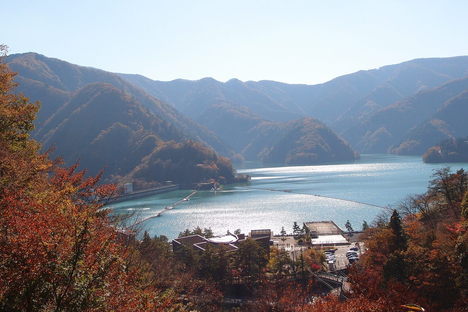
On a weekend morning, ride the Holiday Rapid Okutama from Tokyo Station to Okutama. Take a bus up to Lake Okutama
and walk across the Ogochi Dam, then follow the Tama River downstream: suspension bridges in the Hikawa gorge,
the Shiromaru Dam fish ladder, the Hatonosu gorge, and the Mitake Gorge path to the Sawanoi brewery. Timed to each train and stop.
How the route works
The route goes up to Lake Okutama, the farthest point, first, then follows the Tama River downstream. You work back toward Tokyo one Ome Line station at a time, walking the gorges between stations. By the time you board the train home, you have come down out of the mountains toward the villages.
Three ideas shaped it:
- The lake first thing — buses to the lake run one to three times an hour. Get to the farthest point in the morning, and you need not watch the clock on the way back
- The train for one stop at a time — Okutama to Shiromaru and Hatonosu to Mitake are short hops. Shiromaru to Hatonosu and Mitake to Sawai you walk, along the river
- End at the brewery — after the walking, a drink at Sawanoi-en overlooking the river. Sawai Station is just up the hill, so there is no rush for the train
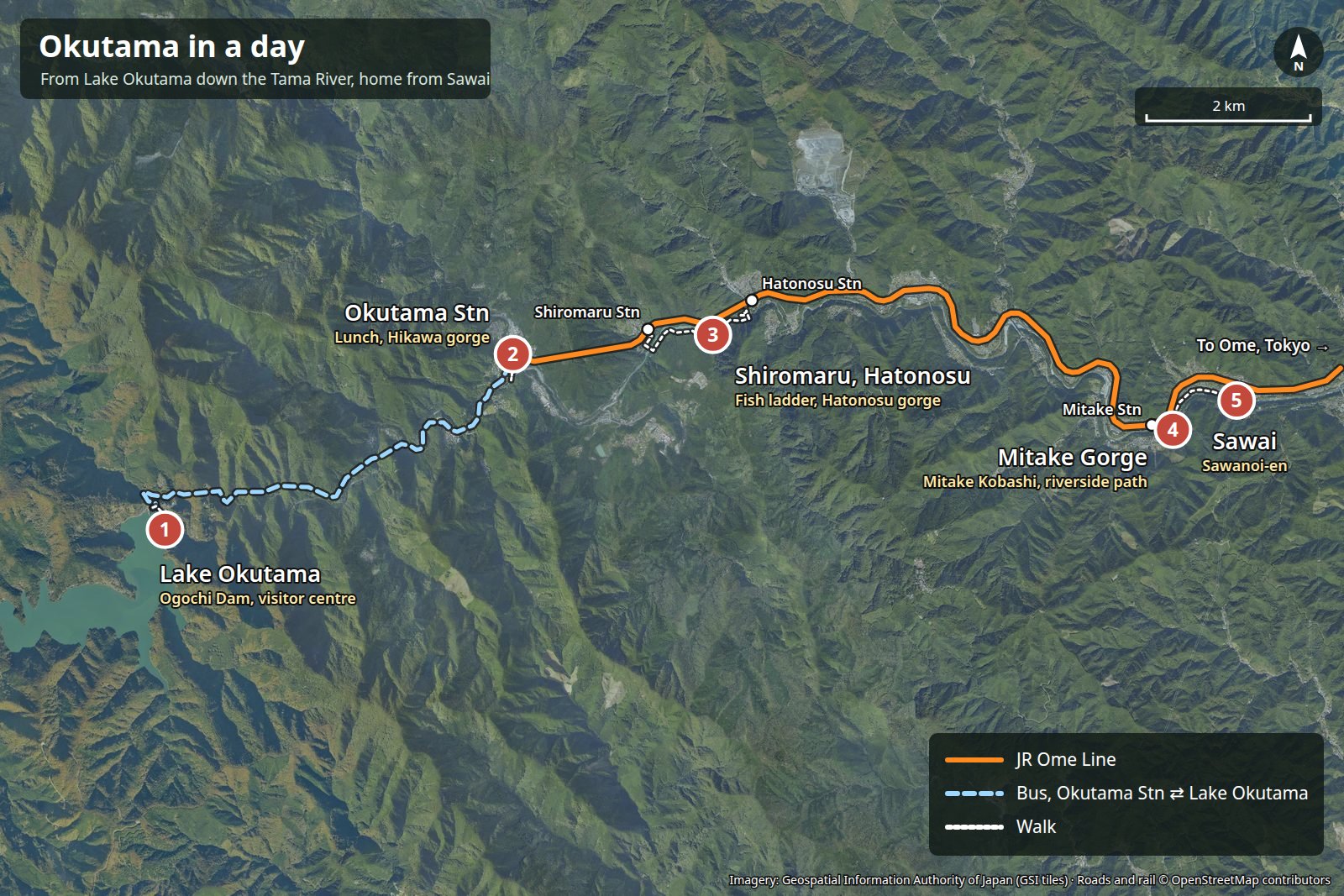
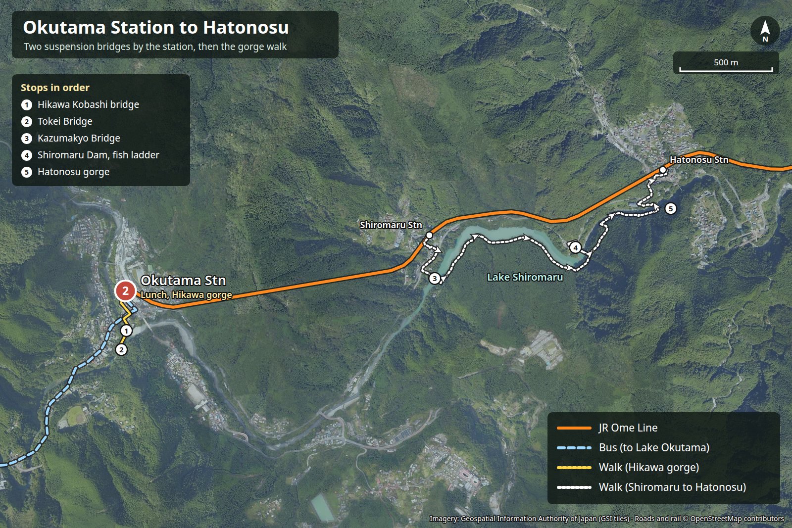
The five stops, in map order:
| No. | Stop | In a line |
|---|---|---|
| ① | Lake Okutama | Walk across the top of the Ogochi Dam, which holds back Tokyo’s reservoir |
| ② | Okutama Station | A chalet-style station, and suspension bridges five minutes away |
| ③ | Shiromaru and Hatonosu | Emerald Lake Shiromaru, the dam’s fish ladder, the Hatonosu gorge |
| ④ | Mitake Gorge | A path right beside the Tama River |
| ⑤ | Sawai | Sawanoi-en at the Sawanoi brewery, and Fukyo Bridge |
The day, hour by hour
Take the 7:29 Holiday Rapid Okutama No. 3 from Tokyo Station, at Okutama by 9:16. The lake in the morning, then down through Shiromaru, Hatonosu and Mitake in the afternoon. Leave Sawai at 16:56, change at Ome to the Holiday Rapid Okutama No. 6, and reach Tokyo at 18:36.
How the day splits (numbers are the stops on the map)
One example, checked against the October 2026 Saturday timetable
| Time | Leg | How / how long | Notes |
|---|---|---|---|
| 07:29 | Tokyo → Ome → Okutama (09:16) | JR Holiday Rapid Okutama, 1 h 47 min, ¥1,410 | Change at Ome for Okutama (2 min). From Shinjuku, 7:44 |
| 09:30 | Okutama Station → Lake Okutama (09:45) | Nishi Tokyo Bus, 15 min, ¥430 | Stop 2 outside the station; buses for Kamosawa-nishi and others |
| 09:45 | ① Water and Green Visitor Center | About 30 min | Free; opens 9:30 |
| 10:15 | ① Across the Ogochi Dam to the viewing tower | About 1 h 20 min | Tower 10:00–16:00, free |
| 11:40 | Lake Okutama → Okutama Station (11:58) | Nishi Tokyo Bus, 18 min, ¥430 | Next one at 11:58 (arr. 12:15) |
| 12:00 | ② Lunch around Okutama Station | About 50 min | Soba, set meals, cafes |
| 12:50 | ② Hikawa gorge bridges | About 20 min | 5 min walk from the station |
| 13:14 | Okutama → Shiromaru (13:16) | JR Ome Line, 2 min, ¥160 | Just one stop |
| 13:20 | ③ Kazumakyo Bridge, Shiromaru Dam fish ladder | About 50 min | Fish ladder open weekends and holidays, April–November, 10:00–16:00 |
| 14:10 | ③ Hatonosu gorge → Hatonosu Station | About 45 min | About 3 km from Shiromaru Station to Hatonosu Station |
| 14:57 | Hatonosu → Mitake (15:09) | JR Ome Line, 12 min, ¥210 | Next one 15:31 |
| 15:10 | ④ Mitake Kobashi and the gorge | About 30 min | Straight down to the river from the station |
| 15:40 | ④ The path down to Sawai | Walk, about 30 min (1.8 km) | Right beside the Tama River |
| 16:10 | ⑤ Sawanoi-en and Fukyo Bridge | About 45 min | Tasting bar until 16:30 |
| 16:56 | Sawai → Ome → Tokyo (18:36) | JR Ome Line + Holiday Rapid Okutama, 1 h 40 min, ¥1,230 | From Ome at 17:27; Shinjuku 18:22 |
The Holiday Rapid Okutama runs only on Saturdays and holidays. On weekdays, take the Chuo Line to Tachikawa and change to the Ome Line (about two hours from Tokyo to Okutama). In mid-October the sun sets just after five, and the valleys darken earlier, so plan to finish the riverside walks by about 16:30.
Tickets and budget
Four JR rides add up to ¥3,010. On weekends and holidays, the Holiday Pass (Kyujitsu Odekake Pass, ¥2,950), which gives unlimited JR travel as far as Okutama, is slightly cheaper and lets you hop off anywhere without thinking about fares. Buses are extra.
| Item | Per adult | Notes |
|---|---|---|
| JR Tokyo → Okutama | ¥1,410 | ¥1,408 by IC card |
| JR Okutama → Shiromaru | ¥160 | ¥155 by IC card |
| JR Hatonosu → Mitake | ¥210 | ¥209 by IC card |
| JR Sawai → Tokyo | ¥1,230 | ¥1,221 by IC card |
| (Instead of JR fares) Holiday Pass | ¥2,950 | Weekends, holidays and some other dates. Unlimited JR between Tokyo and Okutama |
| Nishi Tokyo Bus, Okutama Stn ⇄ Lake Okutama | ¥860 | ¥430 each way |
| Visitor center, viewing tower, fish ladder | Free | |
| Sawanoi tasting bar | ¥300–600 | Per glass; refills ¥100 off |
| Lunch and snacks | ¥1,500–2,500 | |
| Total, roughly | ¥6,000–7,500 | Souvenirs (local sake etc.) extra |
Chuo Line rapid trains carry Green Cars between Tokyo and Ome (Suica Green fee ¥1,000, payable on top of the Holiday Pass too). Prices reflect JR East’s March 2026 fare revision, as published and searched in October 2026.
The Holiday Rapid to Okutama
Board the Holiday Rapid Okutama on the Chuo Line platforms at Tokyo Station. After Shinjuku and Nakano it turns onto the Ome Line at Tachikawa. Change at Ome for the train to Okutama, and the view outside suddenly turns to mountains.
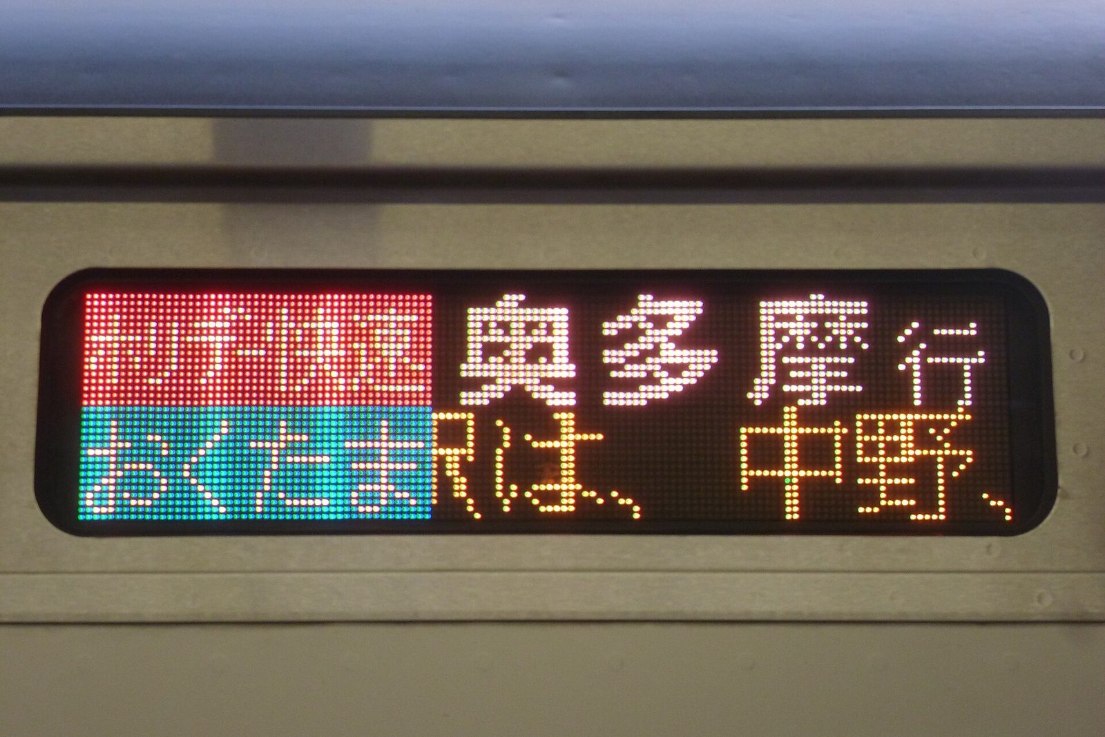
The Ome–Okutama stretch is nicknamed the Tokyo Adventure Line. It climbs the Tama River valley into the mountains, in and out of tunnels and over bridges, with glimpses down into the river’s gorge along the way.
The terminus, Okutama Station, is the westernmost station in Tokyo, at about 343 m above sea level. It is under two hours from Tokyo Station, yet the air feels quite different.
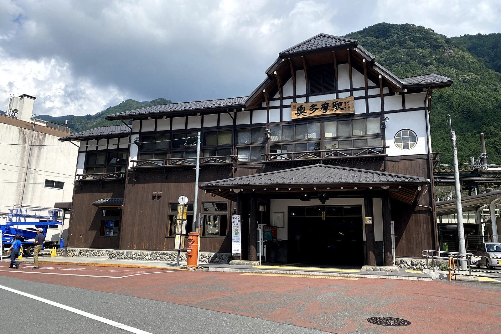
① Lake Okutama: walking the Ogochi Dam
From stop 2 outside the station, a Nishi Tokyo bus (for Kamosawa-nishi and others) takes 15 minutes. Get off not at the end of the line but at Okutama-ko, and the lake and dam are right in front of you.
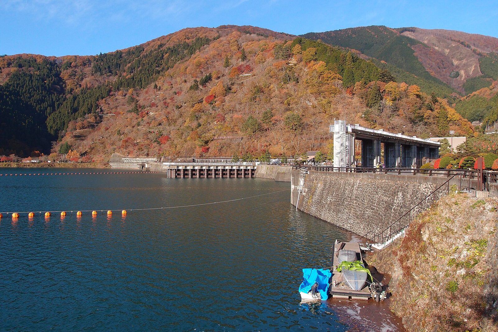
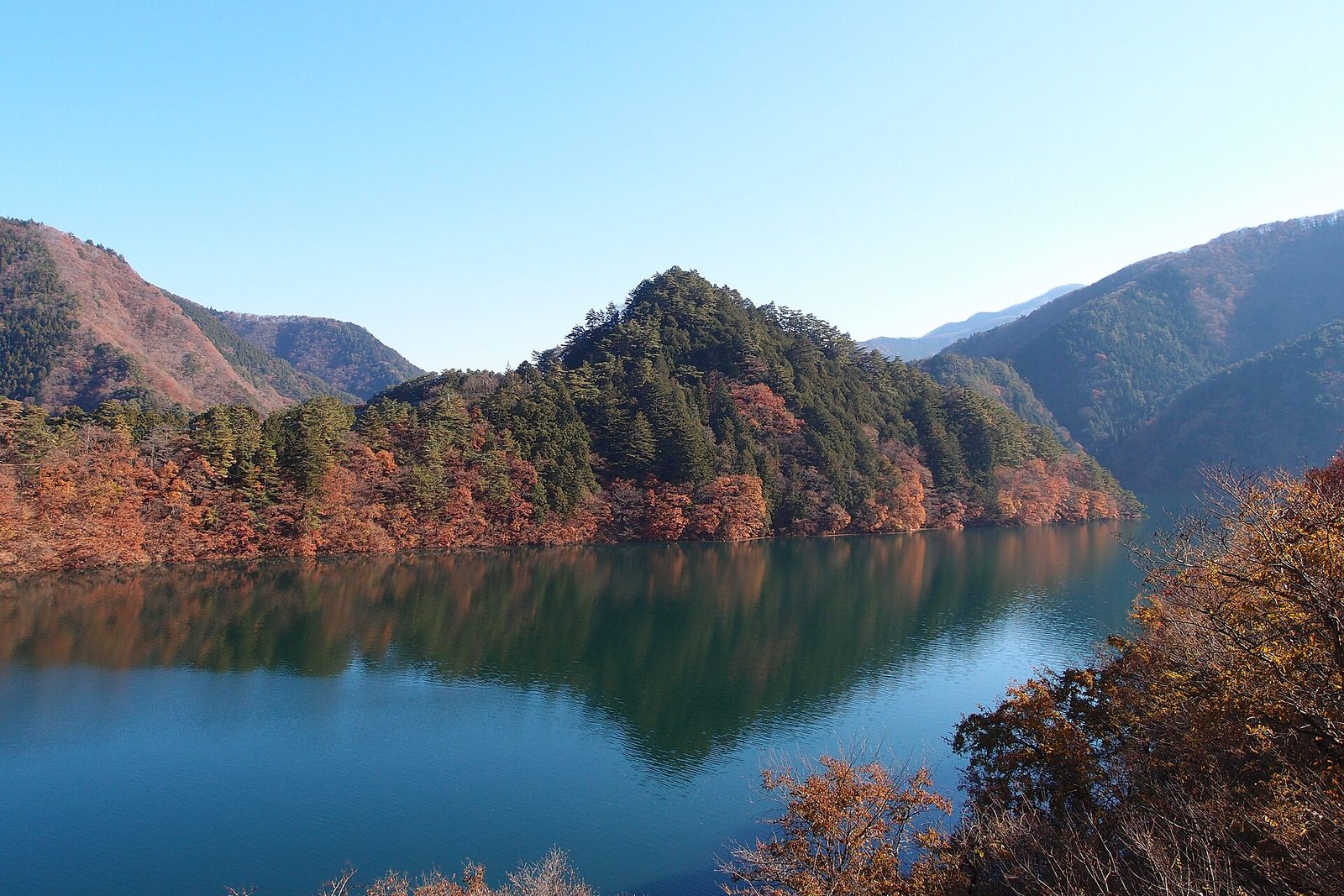
Lake Okutama is a reservoir formed by the Ogochi Dam on the Tama River. Work began in 1938 and, after a wartime halt, the dam was completed in 1957. It is 149 m high, holds about 185 million m³ of usable water, and supplies around a fifth of Tokyo’s water sources. Some of what comes out of the city’s taps starts here.
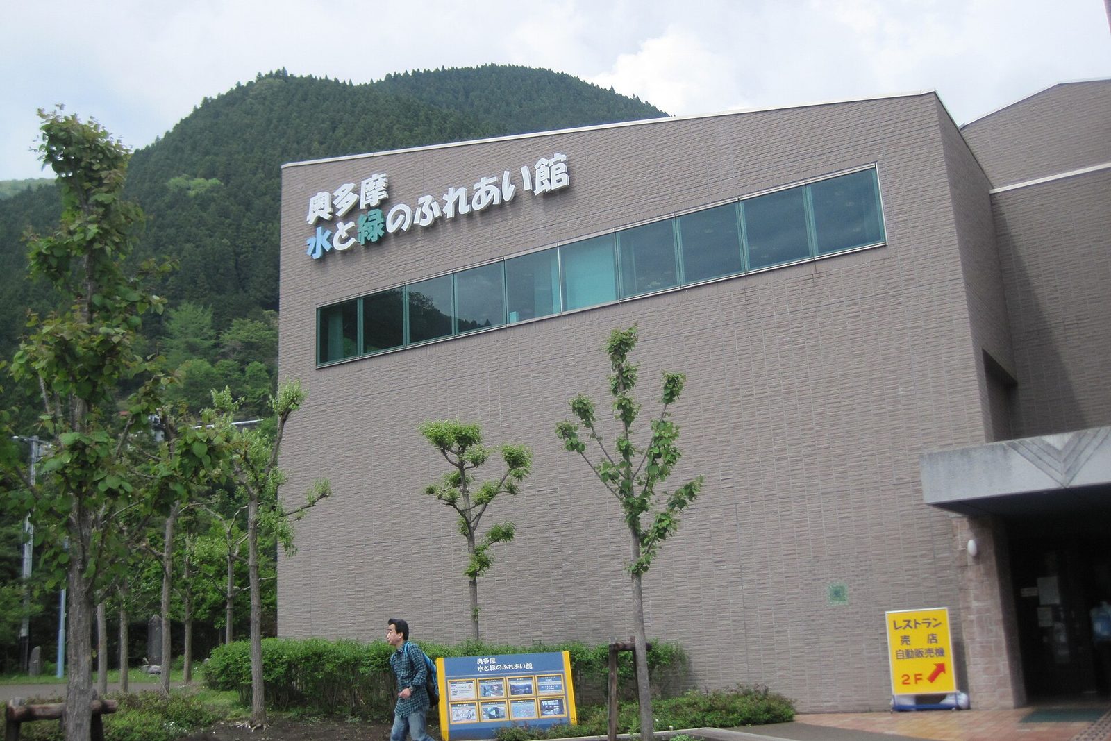
- Okutama Water and Green Visitor Center — Tokyo Waterworks’ exhibit hall opposite the bus stop, with films and hands-on displays on the watershed forest and how the dam works (9:30–17:00, closed Wednesdays, free)
- Across the top of the dam — walk the full 353 m along the crest to the far side. Lake on one side, a 149 m drop to the valley on the other
- Viewing tower — on the far side, the tower looks both over the lake and down the valley below the dam, with displays on the dam’s construction on the second floor (10:00–16:00, free)
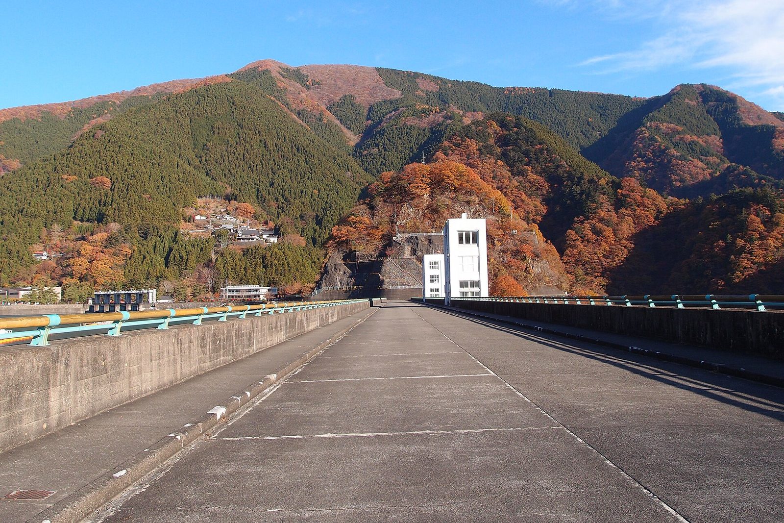
After crossing and coming back, walk a little way along the shore to the bus stop. On a windless day, the mountains are mirrored perfectly in the water.
The visitor center also has a restaurant (10:00–16:00). Take a later bus back and have an early lunch by the lake, if you like.
② Okutama Station: lunch and the Hikawa gorge
Back at Okutama Station, have lunch nearby. Soba shops, diners, cafes and a craft brewery are scattered between the station and the old Ome Kaido road.
After lunch, walk five minutes south of the station to the Hikawa gorge, where the Tama and Nippara rivers meet. Two suspension bridges, the Hikawa Kobashi and the Tokei Bridge, cross high above the water.
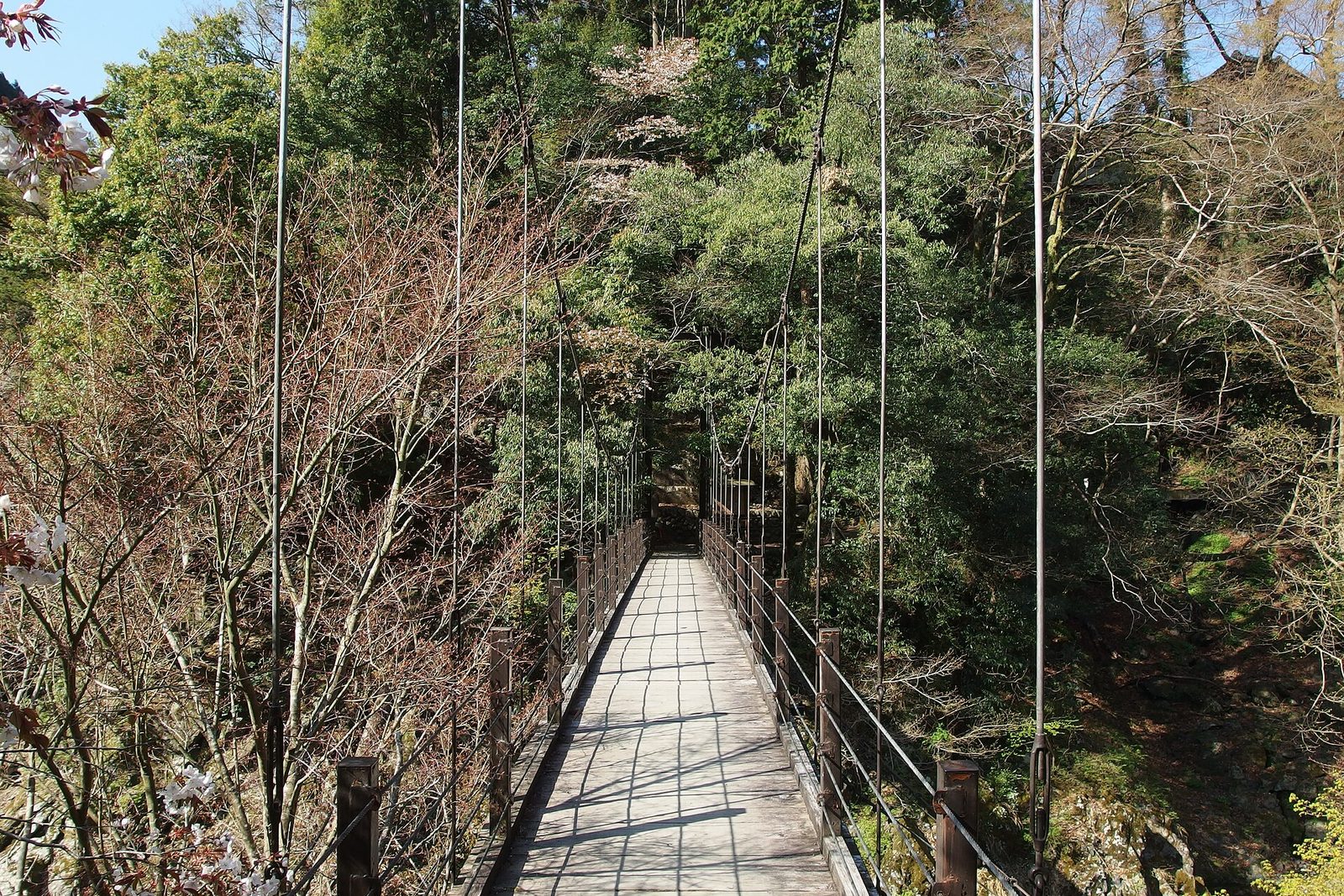
This close to the station, you can already look down into a gorge from a swaying bridge. It is part of a forest-bathing walk laid out by the Okutama Tourism Association; with more time you could spend 40–50 minutes on the riverside trail. Today, cross the bridges and head back for the next train.
③ The Shiromaru fish ladder to the Hatonosu gorge
One stop, two minutes toward Ome, brings you to Shiromaru. Walk down from the little unstaffed station and over the Kazumakyo Bridge, and below you lies Lake Shiromaru, full of emerald-green water.
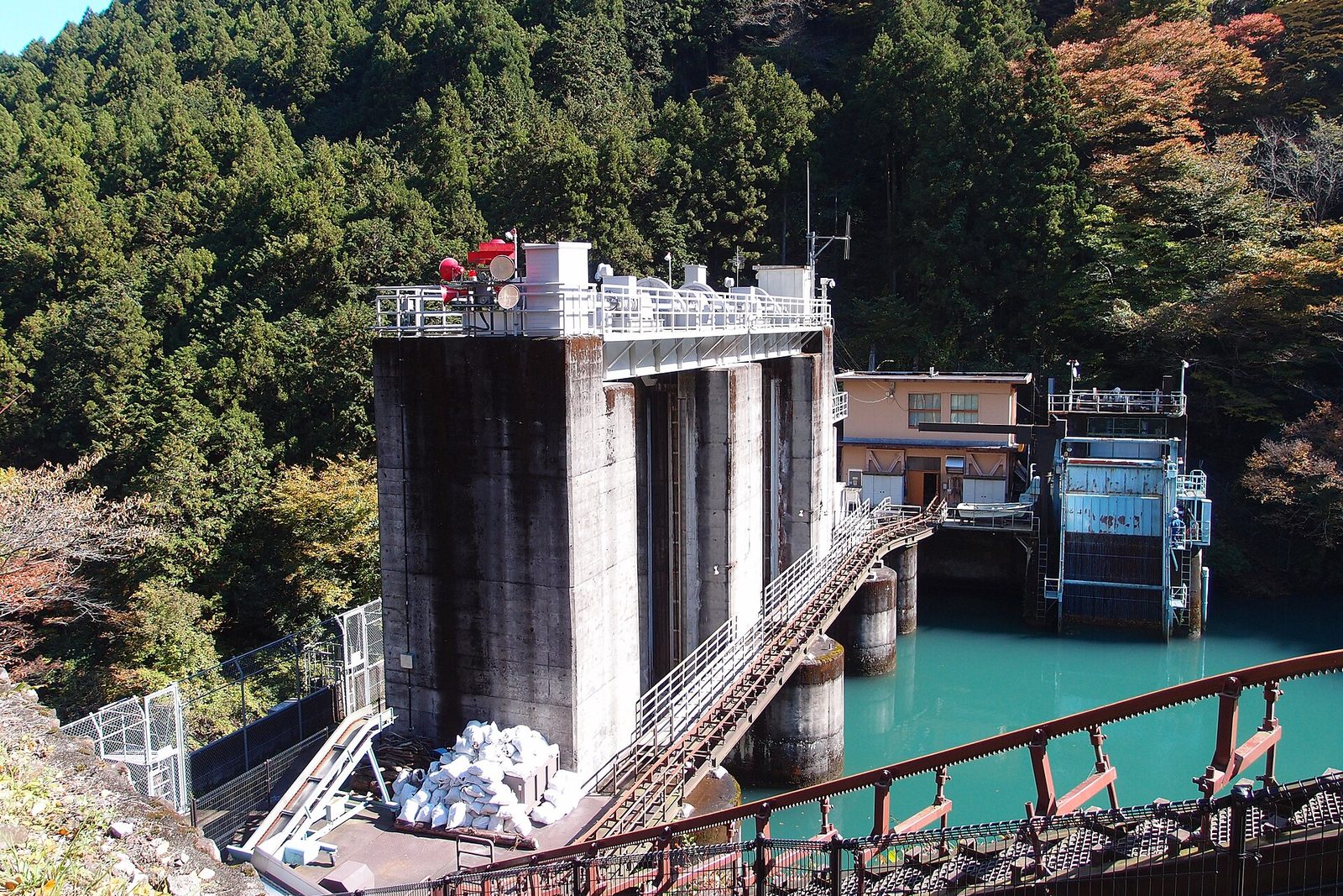
The Shiromaru Dam has a fish ladder for fish that the dam would otherwise stop from swimming upstream. Completed in 2002, it is among the largest in Japan: 331.8 m long, it lifts fish 27 m in a series of stepped pools. On open days you can go down a spiral staircase underground and see the ladder up close.
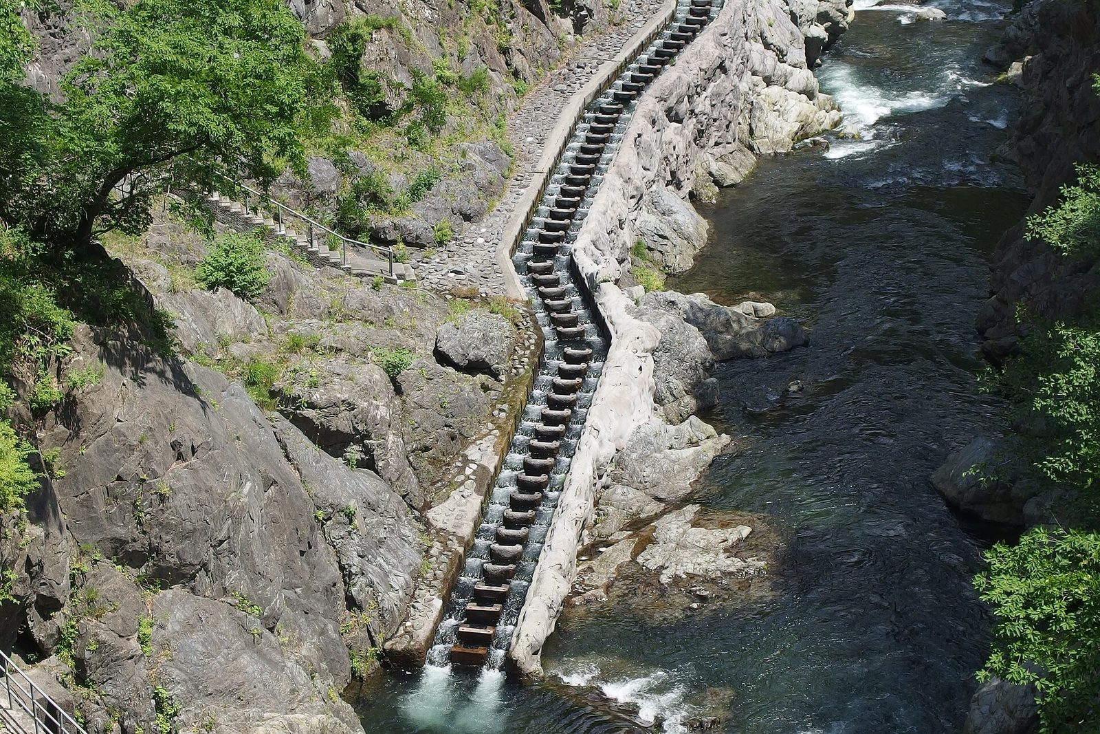
- Open days — Saturdays, Sundays and holidays from April to November (daily in the summer holidays), 10:00–16:00
- Mind the stairs — the spiral staircase is long. If your legs are not up to it, the view from the top of the dam is good too
From the dam, follow the riverside path east for about 20 minutes to the Hatonosu gorge. The Tama River foams white between huge boulders, and the Hatonosu Kobashi suspension bridge spans it, giving a view straight down into the gorge.
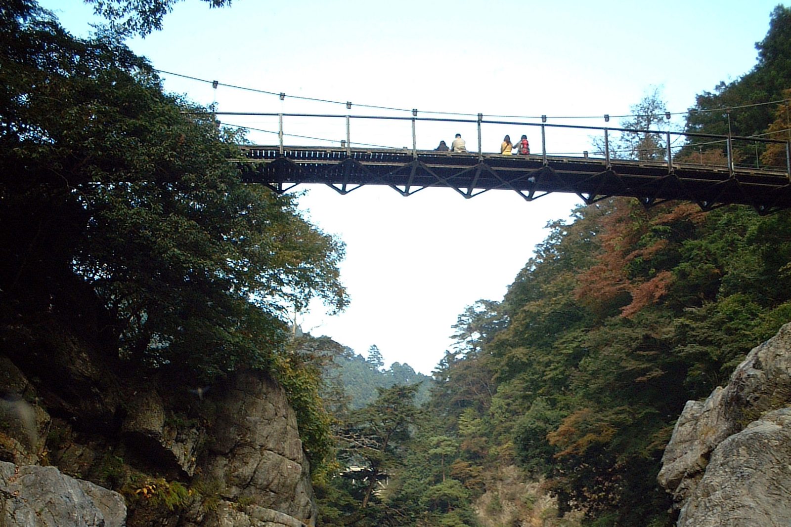
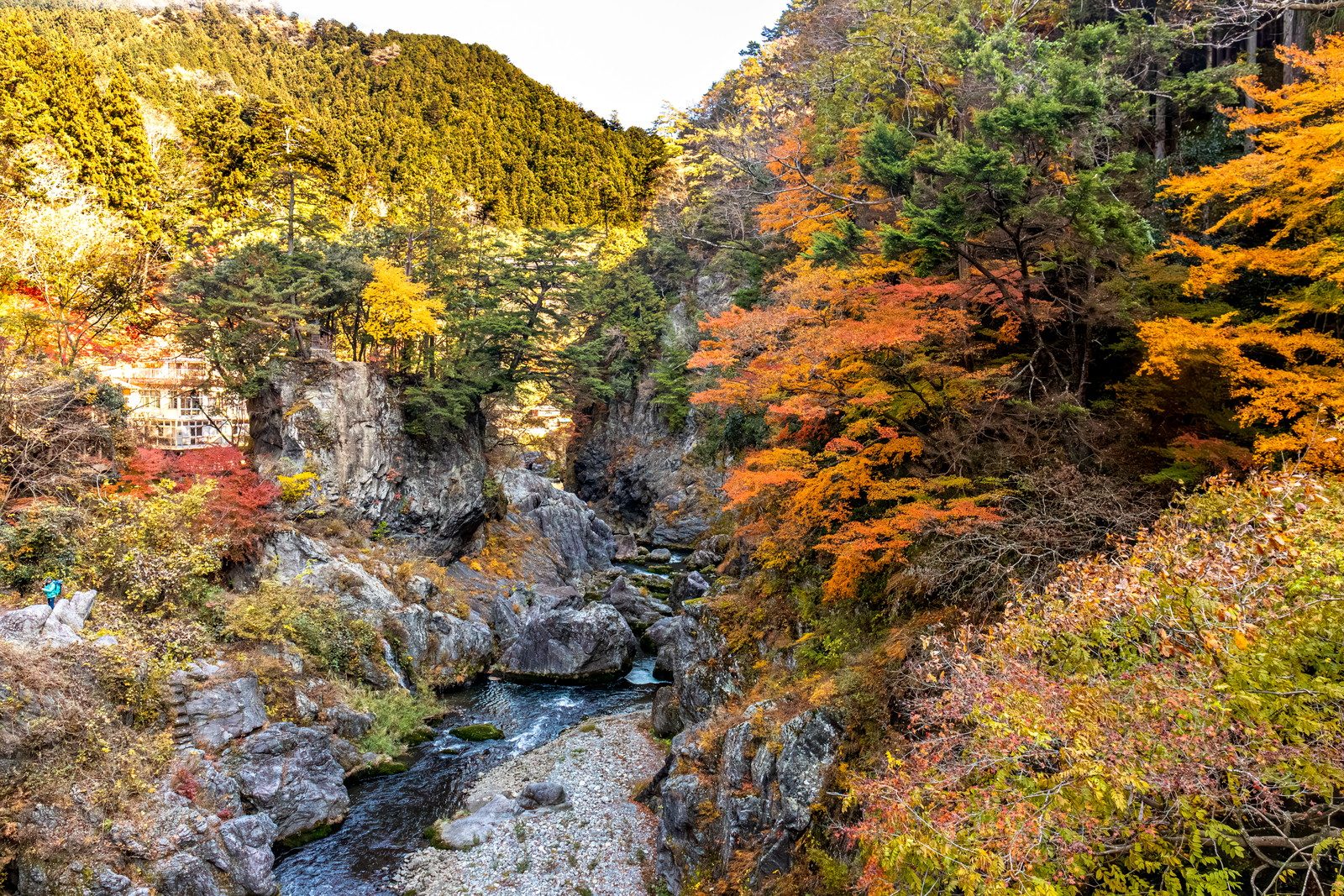
Climb the steps up from the gorge and you reach Hatonosu Station in about ten minutes. From Shiromaru Station it is about an hour and a half with stops.
④ Mitake Gorge: the riverside path
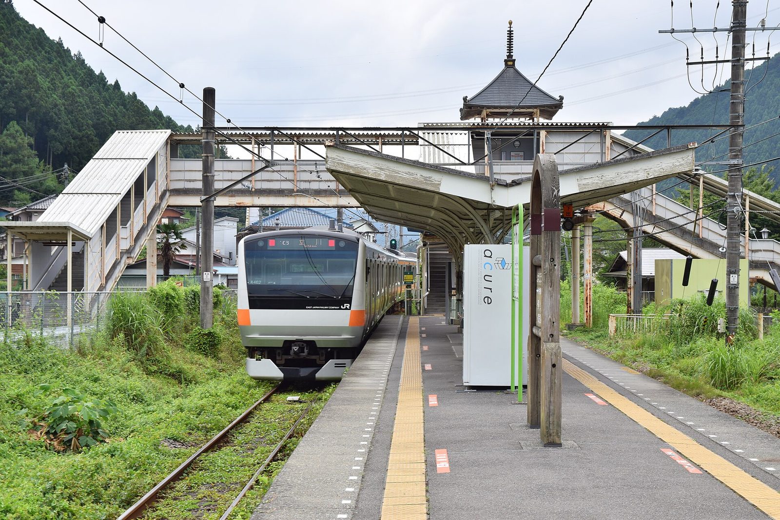
Twelve minutes toward Ome from Hatonosu, get off at Mitake. The temple-style station is the gateway to Mount Mitake and Musashi Mitake Shrine.
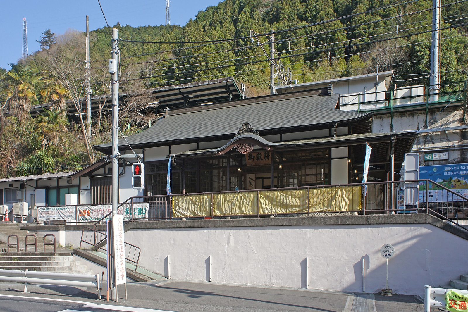
Cross the road in front of the station and walk downhill, and you are soon on the riverbank. From the Mitake Kobashi footbridge down to Sawai, the Mitake Gorge path runs right beside the water.
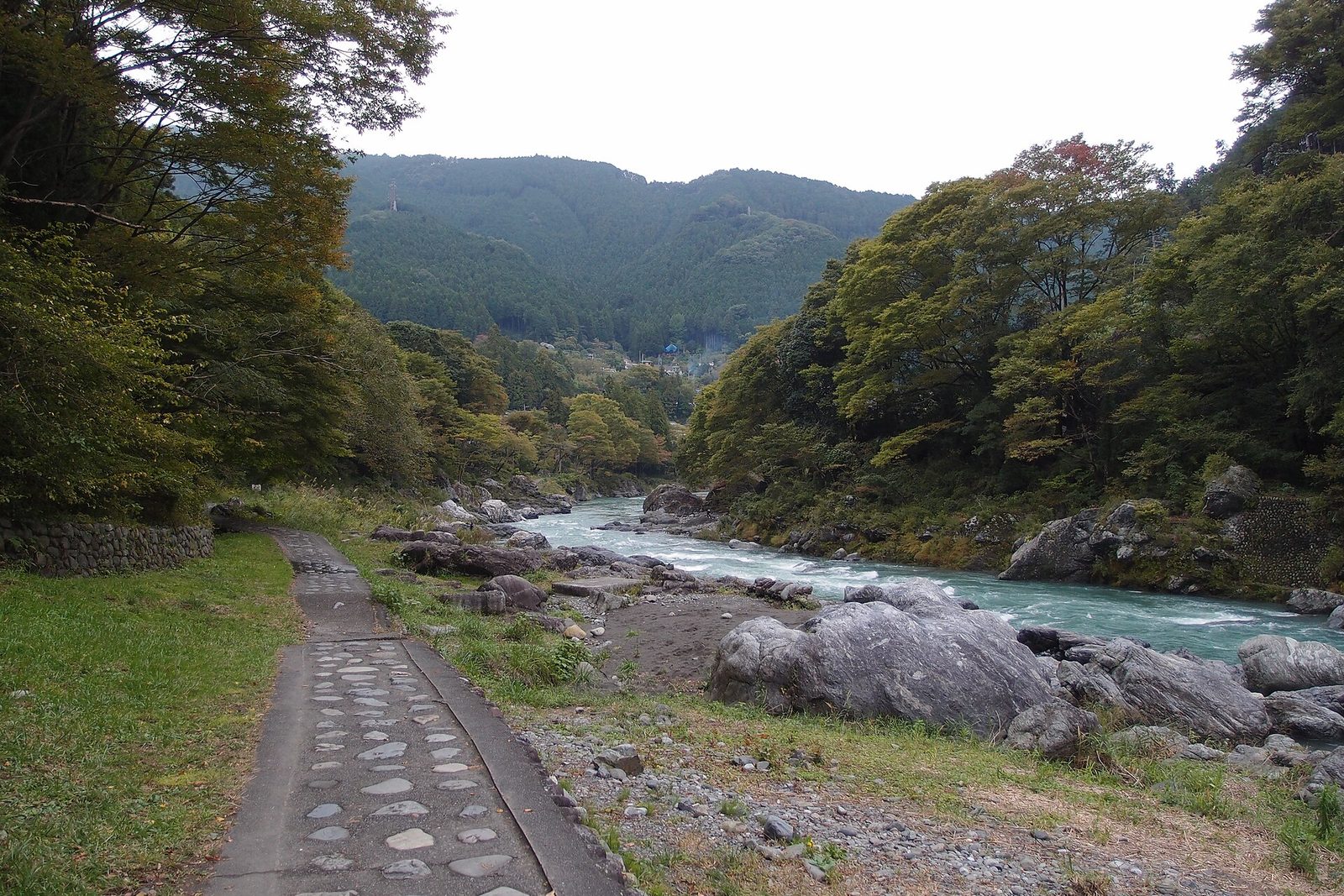
The Mitake Gorge path runs for about 4 km along both banks of the Tama River. Blue water slides between big boulders, and canoes and rafts come down the rapids beside you. Today you walk about 1.8 km of it, from Mitake down to Sawai, with the current.
- Gyokudo Art Museum — by the Mitake Kobashi, a museum devoted to the painter Kawai Gyokudo. Worth a stop if you have time (March–November 10:00–17:00, closed Mondays, ¥500)
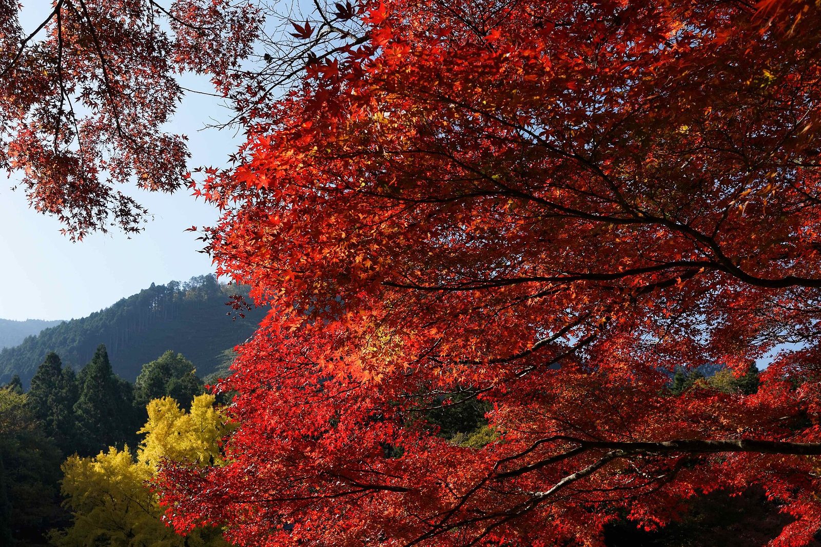
- Autumn colour — the maples along the path usually peak from mid- to late November, and weekends then get busy
⑤ Sawai: Sawanoi-en and Fukyo Bridge
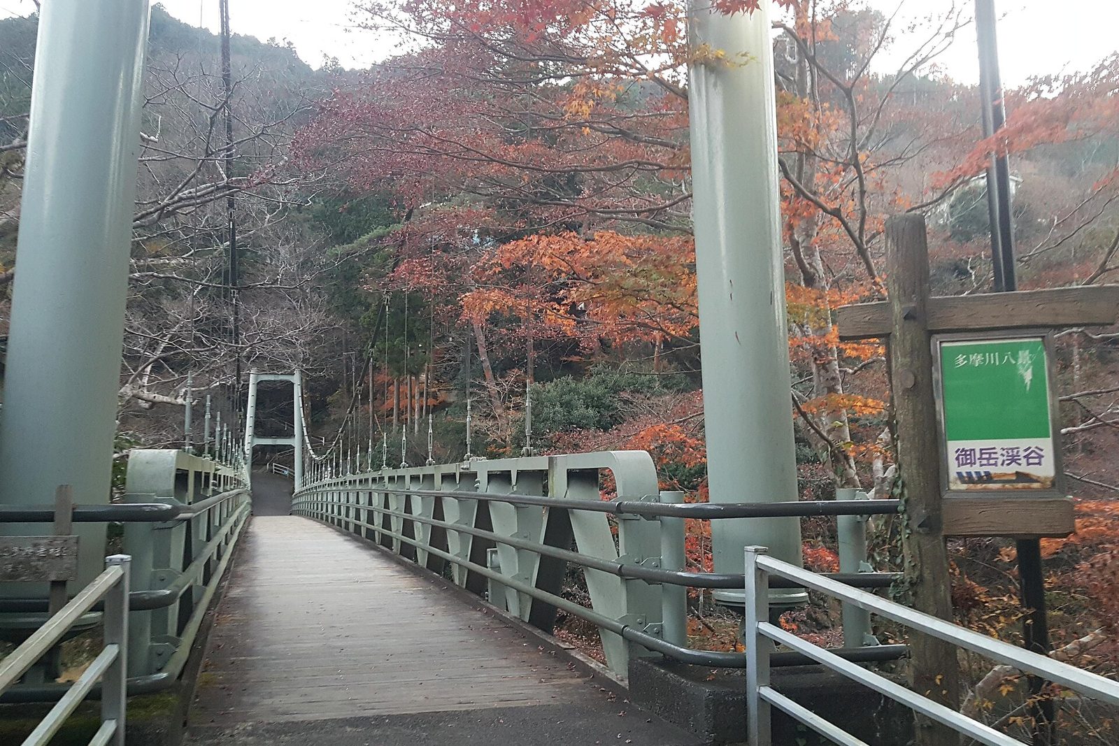
The suspension bridge at the end of the path is Fukyo Bridge, the Maple Bridge. On the far bank stands the small temple of Kanzanji. Both are named after Hanshan Temple in Suzhou, China, and the Tang poem “Night Mooring at Maple Bridge”.
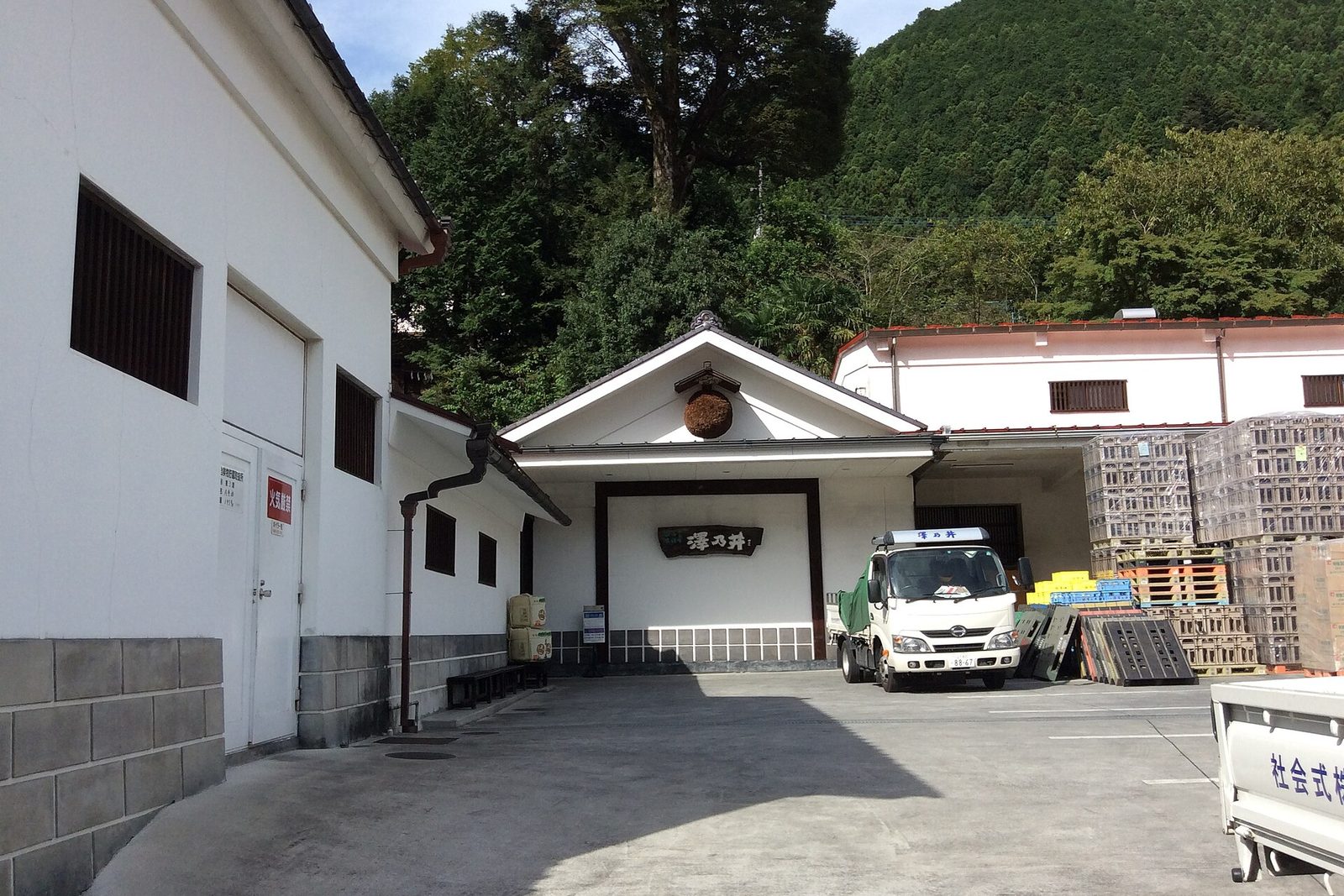
At the end of the bridge is Sawanoi-en, the riverside garden of the Ozawa Shuzo brewery. Founded in 1702, Ozawa Shuzo is one of Tokyo’s own sake breweries, known for the Sawanoi brand.
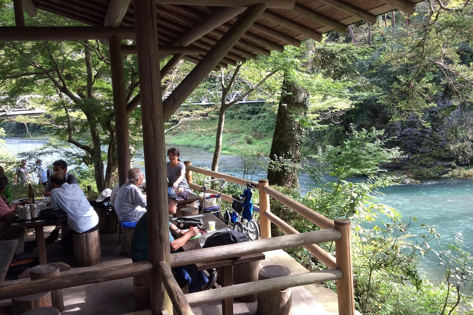
After a day of walking, a drink at a table above the Tama River is a fitting finish. The tasting bar in the garden pours about ten sakes at ¥300–600 a glass. For those who do not drink, there are soft drinks and snacks too.
- Tasting bar — 10:30–16:30; closed Mondays (Tuesdays when Monday is a holiday)
- Sawanoi-en — 10:00–17:00; the shop sells local sake and other souvenirs
- To Sawai Station — cross the Ome Kaido road from the garden and walk about five minutes uphill
Adjusting on the day
Rearrange for the day of the week, the season and your legs. The day of the week matters most: the Holiday Rapid and fish ladder visits are weekends and holidays only; Sawanoi and the Gyokudo Art Museum close on Mondays; the visitor center at the lake closes on Wednesdays.
| If… | Then… |
|---|---|
| You want a brewery tour | Ozawa Shuzo’s tours (about 40 min, ¥700, book online by the day before) run at 11:00, 12:30 and 14:00 on weekends and holidays. Skip Shiromaru and Hatonosu and ride the 13:14 from Okutama straight to Sawai (arr. 13:34) for the 14:00 tour |
| You go in the foliage season | The lakeside colours usually run from late October to late November. Buses and roads are busy on weekends, so take the 9:00 bus to the lake |
| You go on a weekday | There is no Holiday Rapid: take the Chuo Line to Tachikawa and change for the Ome Line. The fish ladder is closed, so see the Shiromaru Dam from outside. On weekdays there are also buses from Okutama Station to the Nippara limestone caves |
| You want to climb a mountain | From Mitake Station, a bus and cable car go up Mount Mitake. Musashi Mitake Shrine and back takes half a day, so drop Lake Okutama and rework the plan |
| You are tired or running late | Shiromaru to Hatonosu is one stop by train (5 min), and Mitake to Sawai four minutes |
| It rains | Gorge paths get slippery and swollen rivers are dangerous. Focus on the visitor center, the Gyokudo Art Museum and Sawanoi-en, and cut the walking short |
Before you go
- Comfortable shoes — the gorge paths have rocks, steps and tree roots. Expect about 8 km on foot over the day
- Bears — bears are sometimes sighted in the Okutama hills. Check local town and city notices before you go, and make some noise as you walk, with a bell for example
- Check the trains home early — between Ome and Okutama trains run every 30–40 minutes by day. Miss one and you wait, so plan backwards from your train
- After sake, stay off the riverbank — head straight up to Sawai Station
- Check the times — the times here are one example from the October 2026 Saturday timetable. Weekday and holiday services differ, so check a route planner the day before
§ — On one page
- The 7:29 Holiday Rapid Okutama from Tokyo, at Okutama by 9:16 (weekends and holidays). Home from Sawai at 16:56, change at Ome, Tokyo at 18:36.
- First, the bus to Lake Okutama: the visitor center, across the Ogochi Dam and the viewing tower. All free.
- Lunch at Okutama Station and the Hikawa gorge bridges. One stop to Shiromaru, then walk past the fish ladder and through the Hatonosu gorge to Hatonosu Station.
- From Mitake, walk the Mitake Gorge path downstream, cross Fukyo Bridge, and have a drink at Sawanoi-en.
- Budget about ¥6,000–7,500 per person. The Holiday Pass saves a little. The fish ladder and the Holiday Rapid are weekends and holidays only.
References
- JR East — Holiday Pass (Japanese)
- Nishi Tokyo Bus — Okutama Station stops (Japanese)
- Tokyo Waterworks — Okutama Water and Green Visitor Center (Japanese)
- Tokyo Waterworks — Ogochi Dam (Japanese)
- Okutama Tourism Association — Hikawa gorge trail map (PDF, Japanese)
- Tokyo Metropolitan Government — Hatonosu gorge to Shiromaru (Japanese)
- Ome Tourism Association — Mitake Gorge path (Japanese)
- Sawanoi — brewery tours (Japanese)
- Sawanoi — tasting bar (Japanese)
- Geospatial Information Authority of Japan — GSI tiles (map imagery)
Photos are from Wikimedia Commons under licences that permit reuse; the author and licence are credited under each one. The autumn photos were taken in November; in mid-October the hills are still mostly green. Map imagery is from the Geospatial Information Authority of Japan, with roads and rail from OpenStreetMap data. Times were checked with the NAVITIME route planner and bus timetables against the October 2026 Saturday timetable; prices and hours are as of October 2026 and may change.
Travel Notes No. 5 — Okutama in a Day / 2026.10